WHITEINCH BOUNDARIES
The area represented by Whiteinch Community Council extends beyond the old burgh boundaries.
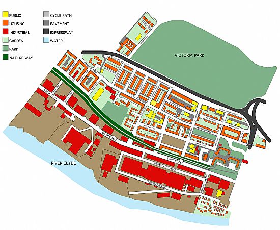
The boundary followed the Partick West boundary exactly, but on June 23rd 2011 some of the boundaries were altered. The new area is bounded to the south by the River Clyde. From the river, the western boundary follows the line of Henrietta Street and the Victoria Park Nature Walk as far as Danes Drive. The northern boundary is defined by Danes Drive and Victoria Park Drive North. The eastern boundary is defined by the edge of Victoria Park, Balshagray Cresent (the end of the G14 postcode) and Ferryden Street back to the Clyde.
WHITEINCH COMMUNITY MAP
We meet at 6:30pm in the Whiteinch Centre on the last Tuesday of the month, excluding July and December.
ACCESSIBILITY STATEMENT
This website is run by Whiteinch Community Council. We want as many people as possible to be able to use this website and we’re always looking to improve the accessibility. If you find any problems or think we’re not meeting accessibility requirements, contact: hello.wcc@email.com
DISCLAIMER: Whiteinch Community Council makes every effort to provide accurate and current information on this website. However, it does not give any warranty or representation of any kind with respect to the accuracy, completeness, appropriateness or currency of the information therein.
In particular end-users should check with any third party organisations listed on this website that information relating to them is accurate and current. The views expressed by any third party organisation listed on this website are not necessarily endorsed by our Community Council.
